Finding the Law Was Never the Hard Part
Where land-use diligence actually breaks down, and what a decision-intelligence layer has to do about it. The code is online, the county runs a GIS portal, and the statute is one search away. Finding text is the easy part. The hard part starts the moment you have all of it in front of you.
Read moreRead less
Ask any land-use attorney what slows a matter down and you will rarely hear “I could not find the ordinance.” The code is online. The county runs a GIS portal. The state statute is one search away. Finding text is the easy part.
The hard part starts the moment you have all of it in front of you.
A system that was never designed to be read as one thing
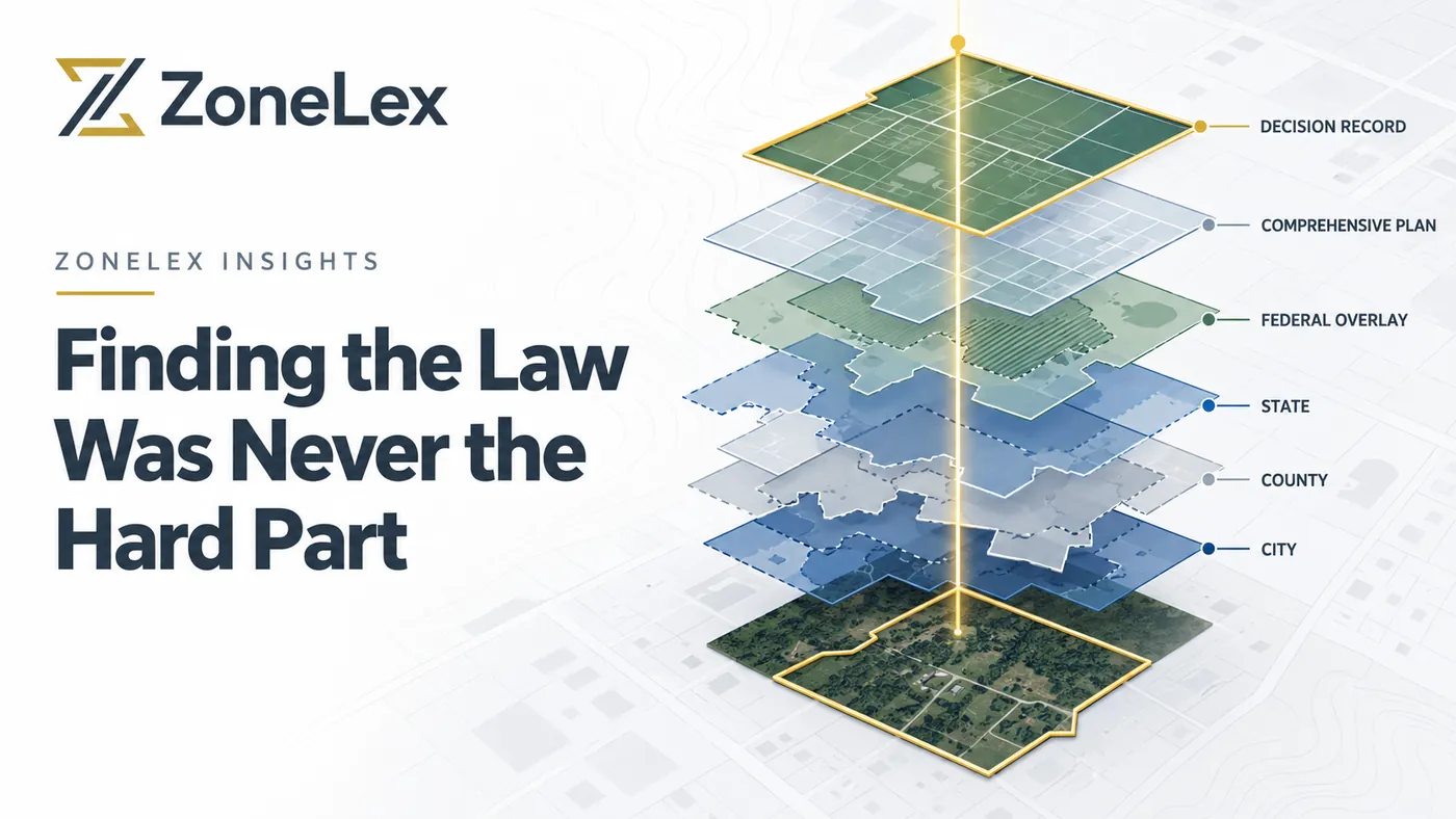
Land-use professionals in the United States work inside a stack of authorities that was assembled over decades, by different bodies, for different reasons: municipal codes, county requirements, state statutes, federal overlays, comprehensive plans, zoning maps, agency guidance, and the public record of past decisions. Each layer publishes on its own schedule, in its own format, with its own idea of what “current” means.
A municipal code posted online may sit six months behind the last adopted ordinance. A staff report may cite a plan amendment that has not been codified yet. A state preemption statute may quietly override a local provision that still appears in the code as if nothing happened.
None of these sources is wrong on its own. The problem is that they do not agree with each other on effective date or level of authority, and nothing in the system tells you that.
This is also why pointing a generic AI model at these materials does not produce legal-grade output. The model can read. The failure is upstream. The underlying information lacks the standardization, the authority structure, and the contextual metadata a system would need to know that one paragraph controls and another has been superseded. Hand it a picture of a PDF and ask which rule governs a parcel, and it will answer confidently and often incorrectly. That is a data problem before it is a model problem, which is why we started there.
Land-use work is not a search problem
Even a perfect search engine only gets you to the starting line. The actual work looks like this:
- Determine which authorities govern this parcel, and in what order.
- Identify where those authorities conflict, and where one preempts another.
- Separate what is permitted by right from what requires discretionary approval.
- Understand the administrative and political record around comparable approvals: who objected, what conditions were attached, how the hearing examiner ruled the last three times.
That last item is where the real value sits. Regional builders and land-use lawyers keep telling us the same thing:
Finding the law is easy. Understanding the historical conversation and sentiment surrounding it is what wins approvals. Context over code.
And the pace of change is accelerating. State preemption bills, federal incentives tied to housing production, pattern books, single-stair reform: all of it is rewriting the relationships between layers of authority faster than most firms can track. Current-law awareness is table stakes. Historical awareness tells you how a jurisdiction got here. Pending-law awareness tells you what your client’s project will face at hearing next spring. You need all three, on every matter, at the same time.
Where a decision-intelligence layer fits
The market that serves this work is fragmented across code publishing, GIS data, zoning reports, feasibility tools, legal AI, and permit systems. Each one solves a slice. None of them connect a parcel to its full governing record and keep that record honest as the law moves.
That gap, the intersection of legal diligence, zoning intelligence, and dynamic regulatory monitoring, is the niche we are building into.
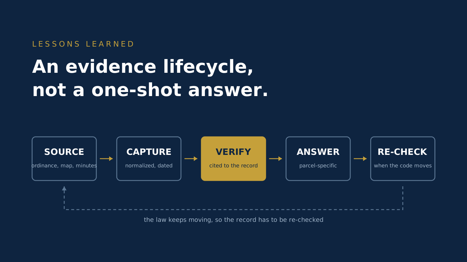
The approach starts with a parcel, because that is where every matter starts. From there: resolve the governing jurisdictions, assemble and version the applicable law, flag authority conflicts and pending changes, and connect the formal requirements to the staff reports, hearings, agendas, minutes, and prior decisions that explain how those requirements actually get applied. The output is a shared, source-linked record the whole team works from: attorney, planner, developer, and client alike, looking at the same binder.
What this should change on a matter
If a layer like this does its job, here is what changes, in the order it matters to the client:
- Parcel-to-issue analysis gets faster.
- Conflicts, preemption, and unresolved authority surface earlier, before design money is spent.
- Preparation for agency discussions, negotiations, and hearings improves, because the record is already in hand.
- Client exposure to delay, redesign, failed acquisition, or missed conditions goes down.
- Awareness of legal change, current and historical, becomes continuous instead of a scramble.
- One regulatory record replaces a dozen versions scattered across email threads.
Behind those sit the quieter wins that partners notice over a year rather than a week: more consistent work product, better delegation across the team, source-linked defensibility for every determination, easier client status reporting, institutional knowledge that stays with the firm when someone retires, and far less exposure to unsupported AI output.
What this is not
Land use is dealmaking. The attorney’s job is not to render a final verdict on a parcel. It is to navigate the client to the best achievable outcome under the code as it exists and the political reality as it stands. No platform replaces that judgment, and none should be issuing legal opinions.
What a platform can do is the digging. Assemble the governing record, show what changed and when, flag where authorities collide, and put the history of prior decisions in front of the practitioner before the hearing rather than after. That leaves the professional with more time for the part of the job that actually requires a professional.
The bottom line
ZoneLex is building the jurisdiction-aware decision-intelligence layer for U.S. land use, starting with land-use law firms and specialized legal teams, where applicability, provenance, and professional review carry the highest value. The same verified data infrastructure will extend to developer feasibility, in-house legal teams, and enterprise API licensing from there.
We do the digging. You do the dealmaking. Beta opens this November, and we are following the build in public along the way.
.jpg)